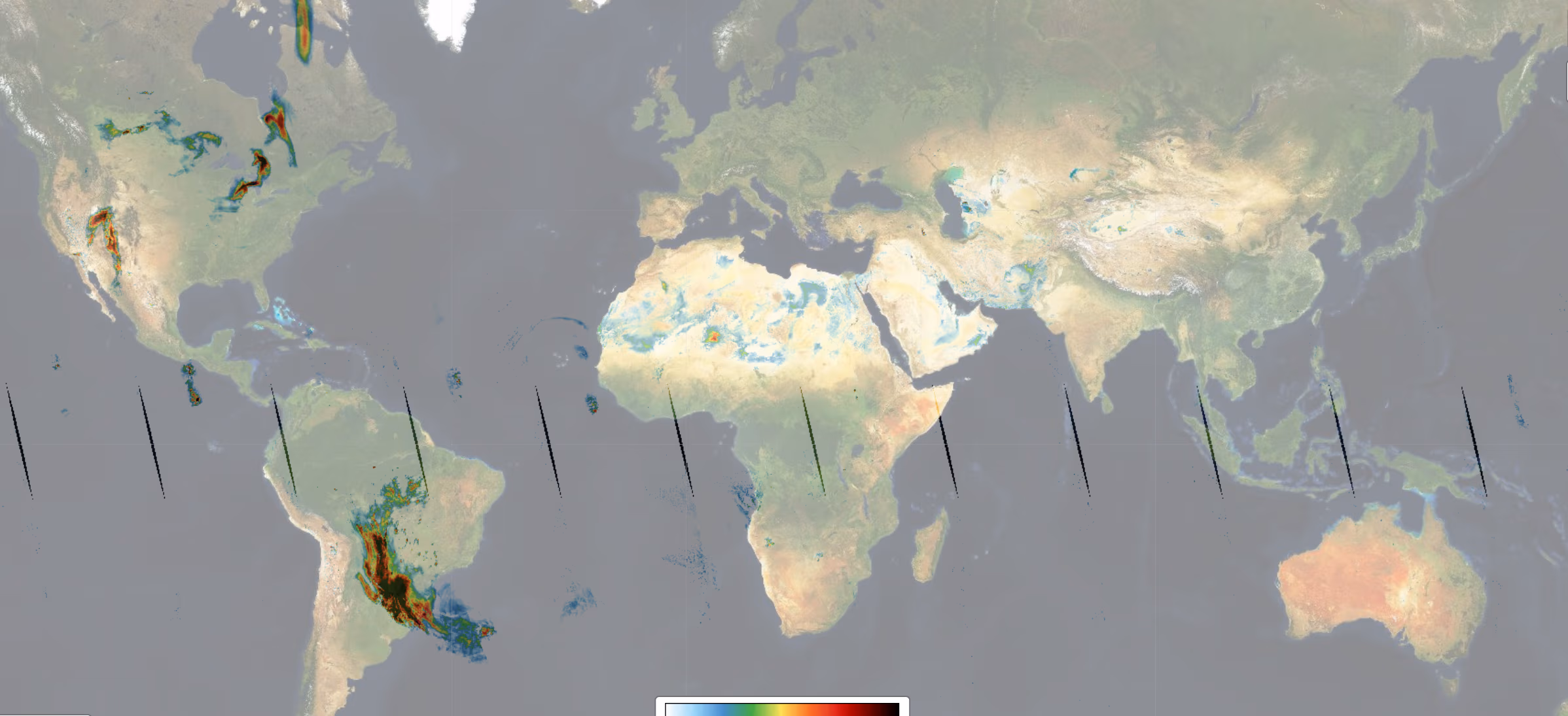
The TROPOMI Aerosol Index (AI), also known as the Ultraviolet Aerosol Index (UVAI), is a well-established data product within the Level-2 processing of S5P/TROPOMI data, with a heritage spanning over 40 years of satellite observations. Its calculation relies on wavelength-dependent changes in Rayleigh scattering within the UV spectral range, where ozone absorption is minimal. Because the AI can be calculated in the presence of clouds, it provides daily, global coverage, making it an ideal tool for tracking the evolution of episodic aerosol plumes from sources such as dust outbreaks, volcanic ash, and biomass burning.
Dataset Specifications
Examples of filenames (a.k.a. granules):
S5P_OFFL_L2__AER_AI_20260201T231910_20260202T010040_43039_03_020901_20260203T132024.nc S5P_NRTI_L2__AER_AI_20260201T235813_20260202T000313_43039_03_020901_20260202T005247.nc S5P_RPRO_L2__AER_AI_20220701T230527_20220702T004657_24439_03_020400_20230126T042632.nc |
|
Elements in the filename separated by underscores after the initial "S5P": |
Dataset Specifications V2 | |
| Temporal Coverage |
Since 01-Jul-2021 Reprocessed (RPRO) dataset: from 30-Apr-2018 to 25-Jul-2022 |
| Spatial Coverage |
~2600 km swath Full daily surface coverage of radiance and reflectance measurements for latitudes > 7° and < -7°, and better than 95 % coverage for latitudes in the interval [-7°, 7°] |
| Spatial Resolution at Nadir |
3.5 x 7.0 km (across x along track), at beginning of mission 3.5 x 5.5 km (across x along track), since 6 August 2019 |
| Processor Version | 02.xx.xx, with x=any digit between 0 and 9 |
Dataset Specifications V1 | |
| Temporal Coverage |
From 30-Apr-2018 to 01-Jul-2021 |
| Spatial Coverage |
~2600 km swath Full daily surface coverage of radiance and reflectance measurements for latitudes > 7° and < -7°, and better than 95 % coverage for latitudes in the interval [-7°, 7°] |
| Spatial Resolution at Nadir |
3.5 x 7.0 km (across x along track), at beginning of mission 3.5 x 5.5 km (across x along track), since 6 August 2019 |
| Processor Version | 01.xx.xx, with x=any digit between 0 and 9 |
How to Access the Data
The data related to this product and to the other S5P/TROPOMI products are accessible via the Copernicus Data Space Ecosystem (CDSE).
Documentation and Related Datasets
Technical documentation on the S5P/TROPOMI Level-1B and Level-2 products can be found on the SentiWiki S5P Products page.
Dataset Citation Guidelines
Users, who, in their research, use ESA Earth Observation data that have been assigned a DOI, are asked to use it when citing the data source in their publications:
Dataset Citation Guidelines V2 |
| Copernicus Sentinel-5P (processed by ESA), 2021, TROPOMI Level 2 Aerosol Index products. Version 02. European Space Agency. https://doi.org/10.5270/S5P-3dgz66p |
Dataset Citation Guidelines V1 |
| Copernicus Sentinel-5P (processed by ESA), 2018, TROPOMI Level 2 Aerosol Index products. Version 01. European Space Agency. https://doi.org/10.5270/S5P-0wafvaf |