Below is a list of available TROPOMI data products (left column) and their corresponding identifiers (right column). Each link leads to a dedicated subpage featuring a product overview, dataset specifications, documentation access, and citation guidelines.
Data Product List
Level-1B Data Products | ||
|
L1B_RA_BDx, x=1 to 8 | ||
|
L1B_IR_UVN, L1B_IR_SIR | ||
Level-2 Data Products | ||
|
L2__AER_AI | ||
|
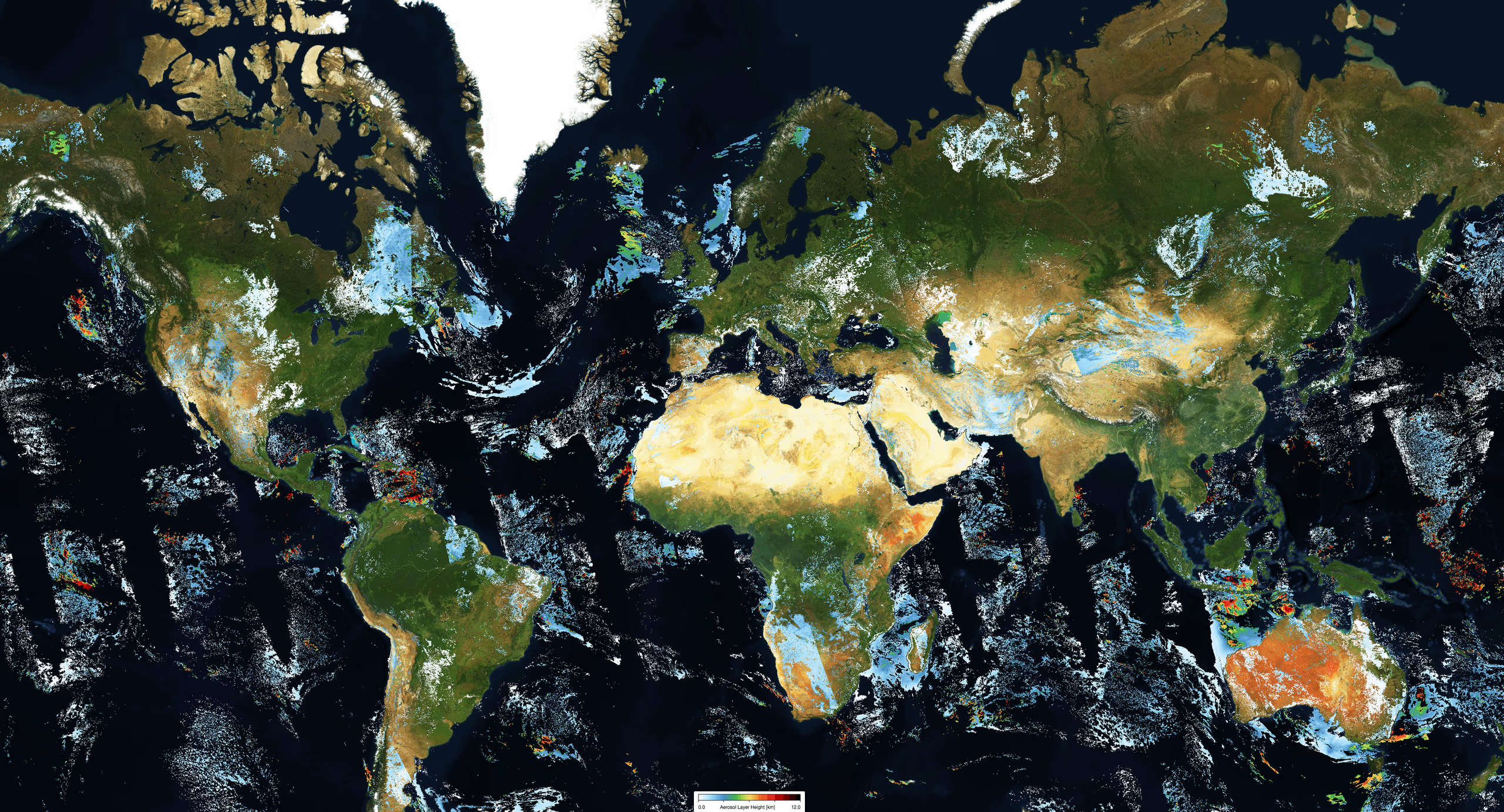
L2__AER_LH | ||
| Carbon Monoxide | L2__CO____ | |
| Cloud Properties | L2__CLOUD_ | |
| Formaldehyde | L2__HCHO__ | |
| Methane | L2__CH4___ | |
| Nitrogen Dioxide | L2__NO2___ | |
| L2__O3____ | ||
| Ozone Tropospheric Column | L2__O3_TCL | |
| Ozone Profile | L2__O3__PR | |
| Sulfur Dioxide | L2__SO2___ | |
Auxiliary Data Products | ||
| NPP VIIRS Cloud | L2__NP_BDx, x=3, 6, 7 | |
| Surface elevation and classification | L2__AUXDEM | |
| A-priori profile shapes of NO2, HCHO and SO2 | AUX_CTMFCT, AUX_CTMANA | |
| Surface DLER | L3__DLER__ | |
Level-2 Data Products Under Development | ||
| Aerosol Optical Thickness | L2__AER_OT | |
| Bromine Oxide | L2__BRO___ | |
| Chlorine Oxide | L2__OCLO__ | |
| Glyoxal | L2__CHOCHO | |
| Ocean Color | L2__KD____ | |
| Sun-Induced Fluorescence | L2__SIF___ | |
| Surface UV Radiation | L2__UV____ | |
| Water Vapor Total Column | L2__TCWV__ | |