Retrieved ozone profiles are essential for monitoring the evolution of ozone in both the stratosphere and the troposphere. In the stratosphere, the ozone layer acts as a vital shield against harmful solar ultraviolet radiation and is currently recovering from historical depletion caused by man-made Chlorofluorocarbons (CFCs). In the troposphere, ozone acts as a toxic pollutant that plays a complex role in atmospheric chemistry. Furthermore, as an effective greenhouse gas, ozone is a significant factor in ongoing climate change studies.
Key Features and Applications
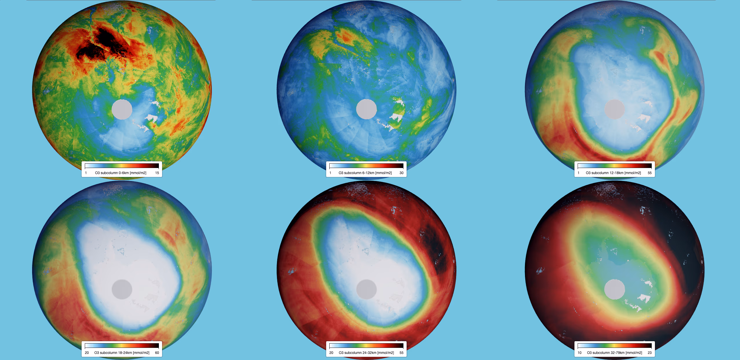
The TROPOMI ozone profile product aims to provide a comprehensive view of vertical ozone distribution to support atmospheric protection and climate research. The main parameters included in the data files are the retrieved ozone profile at 33 pressure levels and the retrieved sub-columns of ozone in 6 distinct layers. In addition, the product provides the total ozone column and tropospheric ozone columns. For advanced users and validation purposes, the dataset also includes precision and smoothing error estimates, the a-priori profile, the covariance matrices, and the averaging kernel.
Dataset Specifications
Examples of filenames (a.k.a. granules):
S5P_OFFL_L2__O3__PR_20260201T231910_20260202T010040_43039_03_020901_20260203T160214.nc S5P_NRTI_L2__O3__PR_20260201T234313_20260201T234813_43039_03_020901_20260202T005328.nc S5P_RPRO_L2__O3__PR_20220701T230527_20220702T004657_24439_03_020400_20230402T183217.nc |
|
Elements in the filename separated by underscores after the initial "S5P": |
Dataset Specifications V2 | |
| Temporal Coverage |
Since Nov-2021 Reprocessed (RPRO) dataset: from 30-Apr-2018 to 25-Jul-2022 |
| Spatial Coverage |
~2600 km swath Full daily surface coverage of radiance and reflectance measurements for latitudes > 7° and < -7°, and better than 95 % coverage for latitudes in the interval [-7°, 7°] |
| Spatial Resolution at Nadir |
28 x 35 km (across x along track), at beginning of mission 28 x 28 km (across x along track), since 6 August 2019 |
| Processor Version | 02.xx.xx, with x=any digit between 0 and 9 |
(No version 1, Initial operational version: v02.03.01)
How to Access the Data
The data related to this product and to the other S5P/TROPOMI products are accessible via the Copernicus Data Space Ecosystem (CDSE).
Documentation and Related Datasets
Technical documentation on the S5P/TROPOMI Level-1B and Level-2 products can be found on the the SentiWiki S5P Products page.
Dataset Citation Guidelines
Users, who, in their research, use ESA Earth Observation data that have been assigned a DOI, are asked to use it when citing the data source in their publications:
Dataset Citation Guidelines V2 |
| Copernicus Sentinel-5P (processed by ESA), 2021, TROPOMI Level 2 Ozone Profile products. Version 02. European Space Agency. https://doi.org/10.5270/S5P-j7l9xvd |