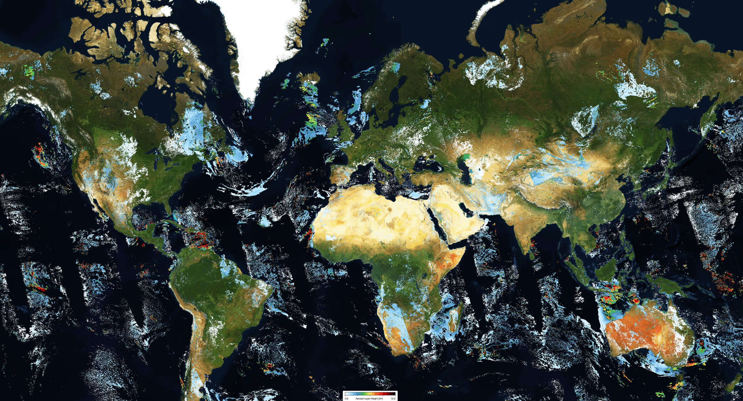
The TROPOMI Aerosol Layer Height (ALH) product provides essential data on vertically localized aerosol layers, such as desert dust, volcanic ash, and biomass burning plumes, situated in the free troposphere. This product is a key component of the Level-2 processing suite for S5P/TROPOMI data.
Technical Methodology
The ALH product uses the Optimal Estimation Method to retrieve aerosol height information under cloud-free conditions. By fitting reflectance spectra across the Oxygen A band, the algorithm calculates the aerosol layer pressure, which represents the mid-pressure level of the plume. This systematic approach ensures accurate vertical profiling, contributing significantly to advancements in atmospheric research and air quality monitoring.
Dataset Specifications
Examples of filenames (a.k.a. granules):
S5P_OFFL_L2__AER_LH_20260201T231910_20260202T010040_43039_03_020901_20260203T160128.nc S5P_NRTI_L2__AER_LH_20260201T234313_20260201T234813_43039_03_020901_20260202T005325.nc S5P_OFFL_L2__AER_LH_20220701T230527_20220702T004657_24439_02_020301_20220703T145054.nc |
|
Elements in the filename separated by underscores after the initial "S5P": |
Dataset Specifications V2 | |
| Temporal Coverage |
Since 01-Jul-2021 Reprocessed (RPRO) dataset: from 30-Apr-2018 to 25-Jul-2022 |
| Spatial Coverage |
~2600 km swath Full daily surface coverage of radiance and reflectance measurements for latitudes > 7° and < -7°, and better than 95 % coverage for latitudes in the interval [-7°, 7°] |
| Spatial Resolution at Nadir |
3.5 x 7.0 km (across x along track), at beginning of mission 3.5 x 5.5 km (across x along track), since 6 August 2019 |
| Processor Version | 02.xx.xx, with x=any digit between 0 and 9 |
Dataset Specifications V1 | |
| Temporal Coverage |
From 30-Apr-2018 to 01-Jul-2021 |
| Spatial Coverage |
~2600 km swath Full daily surface coverage of radiance and reflectance measurements for latitudes > 7° and < -7°, and better than 95 % coverage for latitudes in the interval [-7°, 7°] |
| Spatial Resolution at Nadir |
3.5 x 7.0 km (across x along track), at beginning of mission 3.5 x 5.5 km (across x along track), since 6 August 2019 |
| Processor Version | 01.xx.xx, with x=any digit between 0 and 9 |
How to Access the Data
The data related to this product and to the other S5P/TROPOMI products are accessible via the Copernicus Data Space Ecosystem (CDSE).
Documentation and Related Datasets
Technical documentation on the S5P/TROPOMI Level-1B and Level-2 products can be found on the SentiWiki S5P Products page.
Dataset Citation Guidelines
Users, who, in their research, use ESA Earth Observation data that have been assigned a DOI, are asked to use it when citing the data source in their publications:
Dataset Citation Guidelines V2 |
| Copernicus Sentinel-5P (processed by ESA), 2021, TROPOMI Level 2 Aerosol Layer Height products. Version 02. European Space Agency. https://doi.org/10.5270/S5P-7g4iapn |
Dataset Citation Guidelines V1 |
| Copernicus Sentinel-5P (processed by ESA), 2018, TROPOMI Level 2 Aerosol Layer Height products. Version 01. European Space Agency. https://doi.org/10.5270/S5P-j7aj4gr |